Randall’s Island Park’s Repository
The data repository for Randall’s Island Park serves as a resource hub – a compilation of the ecological and environmental monitoring and assessments performed on the island by the Alliance’s staff and community collaborators. Through this repository, researchers, students and community members can access detailed data sets, reports, and analyses, facilitating further research questions, informed decision-making, and strategic planning.

Randall’s Island Park Alliance staff, volunteers, and members of the public participate in weekly water quality testing. This community-based initiative provides valuable data on water quality and safety by testing enterococcus, a fecal indicator associated with sewage contamination.
2025
2024
2023
2022
2019
2018
2015-17
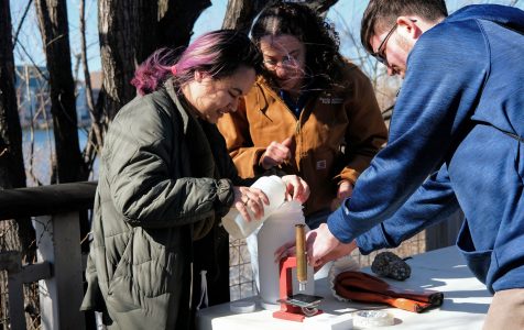
Randall’s Island Natural Areas team collects a variety of water quality parameters including water temperature (C), dissolved oxygen (ppm), and salinity (ppt) to assess fluctuating river conditions. These measurements are documented in a variety of on-going monitoring projects.
2025
2024 - PDF
2024
2023
2022
2021
2020
2019
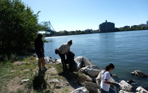
Volunteers on Randall’s Island assist staff in collecting, identifying, and counting types of ocean litter.
2025
2024 - PDF
2024
2023
2022
2021
2020
2019
2018

The WATERS program provided paid, multi-year research and professional development opportunities for high school and college students from communities surrounding Randall’s Island. Through mentored field research, estuarine monitoring, and professional skill-building, interns conducted original ecological studies, contributed to ongoing Hudson River Estuary monitoring, and gained exposure to careers in environmental science and stewardship.
2025 - Salt Marsh Plant Viability
2025 - Marine Debris Dynamics
2025 - Bird Behavior Dynamics
2025 - Oyster Population and Survival

Salt marshes may help reduce nitrogen and phosphorus in ecosystems but it is unclear if restored marshes can provide this function. RIPA and partners at Baruch College measured dissolved gas and nutrient fluxes from salt marshes at Randall’s Island and compared these to adjacent unrestored habitat.
Thanks To Our Sponsors


